


25 July 2010. Mount Nuang is the highest point in Selangor with the height of 1493 meters (4898feet) and part of the Titiwangsa Mountain.
Titiwangsa Mountains (banjaran titiwangsa) are the mountain range that forms the backbone of the Malay Peninsula. The titiwangsa Mountains is part of suture zones that runs north-south, starting in Thailand (Nan-Uttaradit/Dien-Bien-Phu suture zone) and extending south towards peninsular Malaysia (Bentong-Raub suture zone.

There are three hiking routes to the peak that was built by the Malaysian Deparment of Wildlife and national parks. Two of them starts in Selangor, One at Kuala Pangsoon in Hulu Langat Selangor and the other is at Kampung Kemensah in Gombak. The third path originate from Bukit Tinggi in Bentong, Pahang. We took the route from Kuala Pangsoon in Hulu Langat.
THE JOURNEY
We all gathered at Bustanu Pahamin at 5:30am and left for Mount Nuang by 6am. We took the Penchala Link, paid the RM2 toll and drove passed by Desa Sri Hartamas up the sprint highway. On the Sprint highway, we turned left followed the Signboard to Kuala Lumpur and passed by Mid Valley on the left. We took the left exit to Cheras and passed by the Plaza Phenix and paid the toll before taking the first left turn towards Batu 9. We drove and headed towards the Batu Sembilan Police Station and turned left at the Police station traffic light. Then it was a straight drive all the way to Batu 18.
 We reached the Kuala Pangsoon at 7am.
THE TEAM
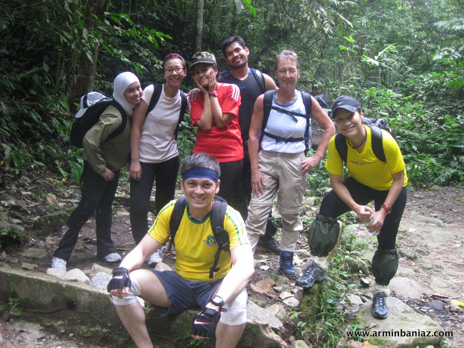
There were Eight of us from ORIGINAL BOOTCAMP MALAYSIA @ Bandar Utama. There were Abu Lais Walli Mohamed (picture on the above), Nawal Aini Zulkifli (picture on the left), Ili Liyana Baharon, Adibah Syazni, Faizal Ariff Abdullah (invited guest), Nyna Mohsen, Sandy Roberts and Armin Baniaz Pahamin.. me.
Except for Nawal Aini Zulkifli, Abu Lais Walli Mohamed and me, it was the first Mountain trekking for the others. Sandy Roberts had trekked Snowdown Mountain, UK dozens of time before.
This expedition is also the final training before we climb Mt Kinabalu next week.

Adibah Syazni

Ili Liyana Baharon

Sandra Oliver Roberts aka Sandy Roberts

Faizal Ariff Abdullah

Nyna Mohsen

Armin Baniaz Pahamin.... me.. Oooh look at my right knee.. This will be a good up/down hill knee-test before Mt Kinabalu.

Sharing some light moment.

We parked the car at the designated car park.. and make our way to toilet located near the entrance for a final poo or pee.
The weather this morning was good. There were no sign of rain and it wasnt too cold either.
After the last poo & pee, we registered with the Department of Wildlife and National Park. I told the Amran, the officer to look out for us if we are not back by evening. There have been to many death and lost in the mountain stories and I do not want to take any risk. We exchange hp number and paid the entrance fee of RM1.00.


THE EXPEDITION BEGAN

After registering and paying the RM1.00 fee, we walk to the Mountain Entrance.
This is my 6th climbed up Mt Nuang and I was surprise to see the development. There is a now an entrance gate, a much bigger public toilet with shower facilities.


Our trail began. The first part of the climb was an hour of trekking on 4WD route.
Having a little bit extra experience up the Mountain, I brief all team-members to respect and never underestimate the Mountain.. Although we are of different fitness level and strength, we should all stick together without any split.
There are too many stories of people getting lost, I felt responsible. Our journey began at 7:20am, checked and clocked my Polar watch with the foot-pod.
I have never calculated the distance from the car park to the peak.


Everybody is within visible sight at all time...

The trail up Mt Nuang was on a steep uphill

We were surrounded by greens...


There were millions of ants... very painful sting if bitten.

There were three rest-stop points before crossing the first river that marked the foot-hill.


We continued our hiking..


Eeeek Kentucky fried chicken in the jungle!!!!

We also passed by a few orang asli houses...


Beautiful greens and the air was so refreshing..

THE FIRST RIVER
The first river marked the end of the 4WD route and the beginning of pure jungle trekking.
We crossed the first river after about 1 hour of trekking the 4wd route. Crossing the river requires a little bit of skill and agility to avoid getting the shoe wet. We had to hop on a few stones to cross.

There were many people Camping by the riverside...


After crossing the river.... we trekked alongside a huge ancient water-pipe for approximately 30 minutes.
Then we reached a steep slope that we had to climbed on a step made out of tree-root.
The step will bring us to an abandon haunted-look like old hut and an abandon water dam.


The water damn used to be filled with water and during every climb up, there is no escaped but to wet the shoe when crossing over.
But this time round, the water level had deterirated and we could easily jumped from the border to the opposite without wetting the shoe.


Crossing over.. is only a jump-over without getting wet.


Some part of the jungle is quite dark...

THE WATERFALL AND CAMPING AREA
A short-trekking later, we reached another river, water-fall and the main camping area....


THE DEEPER JUNGLE TREKKING...
After the water-fall and the main camping area, the route gets tougher, we trekked through a thicker jungle...


It was a strenuous uphill... all the way. Now we began to appreciate Sarge Dann endless squat-pulses and squatting during boocamp malaysia training.


Some part of the jungle does look scary...


After 4 hours of trekking, 8KM uphill from car park, 2500 calories burn... we finally reach the PACAT CAMP.
PACAT CAMP is the last camp before the peak. Mt Nuang peak is another 2 hours climbing from Camp Pacat (depending on fitness level).
The route from Pacat Camp to the peak is more strenuous and challenging as compared tot he route thusfar.
We deliberated if we should continue to the peak and considering Ili Liyana Baharon was having a back ache... and our Group's speed pace, we would reached the peak around 2pm... which will be too late.


We ate our packed lunch that was planned for food at the Peak at the Pacat Camp. I brought fried meehoon with grilled lamb and omelette... Sandy Roberts brought her whole refrigerator and everybody ate their packed lunch.
We met a few other climbers at the Camp Pacat whom all turned back instead of pursuing to the peak. We were all sweaty although it was quite chilly.
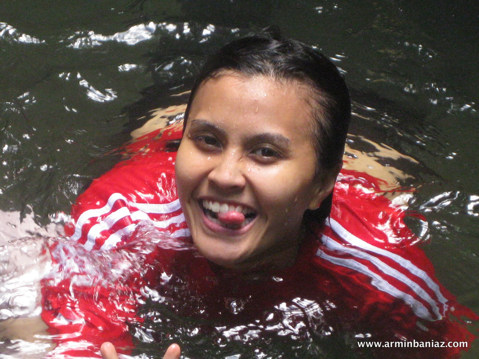
On our way down, we stopby the Waterfall..... and everybody jumped without any hesitation!!! We were too hot and the legs were very tired. The water was freezing cold!!!
FROZEN COLD DIPPING @ WATER-FALLS


After the frozen-water waterfall dip, we trekked down to the car park.... took a shower and monopolise the bench each... Err i mean me & abu took a bench each.

and the ladies.. had to settle for..


We completed the whole expedition in 8 hours, 16km (crazy steep slope) and burn 3,863 calories burn.
The highest heart rate up to Pacat camp was 163bpm but the heart rate cruises at 120bpm during the journey down back to the carpark.
We were hit by a storm, half an hour after we reach the car park... Should we have insisted for the peak and the summit, we would have been stuck in the mountain!!
Thank god, there are always a blessing in disguise. We were very lucky...
Congratulation team for conquering Pacat Camp.


No comments
Post a Comment
Stay Tuned~